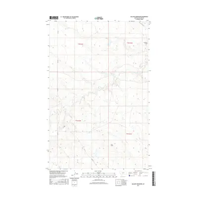
2017 Map of Holzhey Reservoir
USGS Topo · Published 2017About this map
Midale and the surrounding rangelands of Phillips County are defined by a network of drainage coulees and vital water management sites. The landscape is marked by the winding path of Beaver Cr and significant landmarks like Dry Fork Ridge and Button Butte. Local history and genealogy researchers can locate the Midale Cem along Midale Rd, a central thoroughfare connecting the small settlement with nearby agricultural operations like the Emond Ranch.
Find a feature on this map
19 named features on this map. Tap any name to fly to it.
Don’t see what you’re looking for? This feature index may not catch every label — zoom into the map to look around manually.
Map Details
Editions of this 2017 Holzhey Reservoir Map
This is the sole edition of this map. No revisions or reprints were ever made.
Other maps of this area

1953 · Havre
USGS Topo · 1:250,000
1954 · Jordan
USGS Topo · 1:250,000

1954 · Glasgow
USGS Topo · 1:250,000

1954 · Lewistown
USGS Topo · 1:250,000
1956 · Jordan
USGS Topo · 1:250,000

1957 · Glasgow
USGS Topo · 1:250,000

1957 · Havre
USGS Topo · 1:250,000

1958 · Glasgow
USGS Topo · 1:250,000
1958 · Jordan
USGS Topo · 1:250,000

1958 · Havre
USGS Topo · 1:250,000