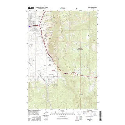
2017 Map of Homestake
USGS Topo · Published 2017About this map
Butte’s eastern edge transitions from urban residential streets like Ottawa St and Floral Blvd into the dense drainages of the Deerlodge National Forest. This 2017 survey documents the topographical complexity where the city meets the Continental Divide. The eastern half of the map is defined by the steep elevation changes of Goldflint Mtn and the numerous canyons that cut through the landscape, such as Wendel Canyon and Brookside Canyon.
Find a feature on this map
118 named features on this map. Tap any name to fly to it.
Don’t see what you’re looking for? This feature index may not catch every label — zoom into the map to look around manually.
Map Details
Editions of this 2017 Homestake Map
This is the sole edition of this map. No revisions or reprints were ever made.
Other maps of this area

1889 · Helena
USGS Topo · 1:250,000

1893 · Helena
USGS Topo · 1:250,000

1893 · Dillon
USGS Topo · 1:250,000

1899 · Boulder
USGS Topo · 1:125,000

1899 · Helena
USGS Topo · 1:250,000

1903 · Helena
USGS Topo · 1:250,000

1947 · Butte
USGS Topo · 1:250,000

1954 · Elk Park
USGS Topo · 1:62,500

1955 · Dillon
USGS Topo · 1:250,000

1957 · Dillon
USGS Topo · 1:250,000