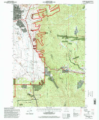
1996 Map of Homestake
USGS Topo · Published 1998About this map
The Continental Divide creates a prominent topographical spine across this landscape, separating the urbanized edges of Butte from the deep timber of the Deerlodge National Forest. To the west, the map shows the expansion of city life through the Floral Park neighborhood, the grounds of the Whittier School, and the extensive runways of the Bert Mooney Airport. This transition from city to wilderness is marked by extractive history, with numerous prospects and a Mine Dump scattered near the Butte Country Club and Skones Gulch.
Find a feature on this map
47 named features on this map. Tap any name to fly to it.
Don’t see what you’re looking for? This feature index may not catch every label — zoom into the map to look around manually.
Map Details
Editions of this 1996 Homestake Map
This is the sole edition of this map. No revisions or reprints were ever made.
Other maps of this area

1889 · Helena
USGS Topo · 1:250,000

1893 · Helena
USGS Topo · 1:250,000

1893 · Dillon
USGS Topo · 1:250,000

1899 · Boulder
USGS Topo · 1:125,000

1899 · Helena
USGS Topo · 1:250,000

1903 · Helena
USGS Topo · 1:250,000

1947 · Butte
USGS Topo · 1:250,000

1954 · Elk Park
USGS Topo · 1:62,500

1955 · Dillon
USGS Topo · 1:250,000

1957 · Dillon
USGS Topo · 1:250,000