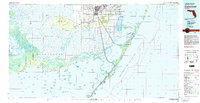
1982 Map of Homestead
USGS Topo · Published 1983About this map
Homestead and Florida City serve as the gateway to the vast sub-tropical wilderness at the southern tip of the Florida peninsula in the early 1980s. This survey illustrates the intricate relationship between growing residential developments like Leisure City and the surrounding protected landscapes of Everglades National Park and Biscayne National Park. The industrial and military footprint of the era is anchored by Homestead Air Force Base, while the agricultural and aviation needs are met by the Homestead General Aviation Airport.
Find a feature on this map
55 named features on this map. Tap any name to fly to it.
Don’t see what you’re looking for? This feature index may not catch every label — zoom into the map to look around manually.
Map Details
Editions of this 1982 Homestead Map
2 editions found
Other maps of this area

1947 · Garden Cove
USGS Topo · 1:24,000

1947 · Rock Harbor
USGS Topo · 1:24,000

1947 · Blackwater Sound
USGS Topo · 1:24,000

1948 · Soldier Key
USGS Topo · 1:24,000

1949 · Blackwater Sound
USGS Topo · 1:24,000

1949 · Rock Harbor
USGS Topo · 1:24,000

1949 · Garden Cove
USGS Topo · 1:24,000

1949 · Elliott Key
USGS Topo · 1:24,000

1949 · Card Sound
USGS Topo · 1:24,000

1949 · Pacific Reef
USGS Topo · 1:24,000