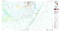
1982 Map of Homestead
USGS Topo · Published 1983About this map
Homestead Air Force Base and the adjacent agricultural communities of Homestead and Florida City serve as the focal point of this South Florida landscape, where the developed coastal ridge meets the wilderness of the Everglades National Park. The map documents the intricate transition from the limestone upland of Long Pine Key to the vast sawgrass prairies of the Shark River Slough. Along the coast, the early 1980s infrastructure is clearly defined, featuring the Old Dixie Highway and the Toll Road leading toward the upper Florida Keys.
Find a feature on this map
125 named features on this map. Tap any name to fly to it.
Don’t see what you’re looking for? This feature index may not catch every label — zoom into the map to look around manually.
Map Details
Editions of this 1982 Homestead Map
2 editions found
Other maps of this area

1947 · Garden Cove
USGS Topo · 1:24,000

1947 · Rock Harbor
USGS Topo · 1:24,000

1947 · Blackwater Sound
USGS Topo · 1:24,000

1948 · Soldier Key
USGS Topo · 1:24,000

1949 · Blackwater Sound
USGS Topo · 1:24,000

1949 · Rock Harbor
USGS Topo · 1:24,000

1949 · Garden Cove
USGS Topo · 1:24,000

1949 · Elliott Key
USGS Topo · 1:24,000

1949 · Card Sound
USGS Topo · 1:24,000

1949 · Pacific Reef
USGS Topo · 1:24,000