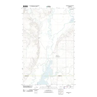
2011 Map of Homestead
USGS Topo · Published 2011About this map
Big Muddy Creek winds through the heart of this Sheridan County landscape, carving a complex, meandering path across the terrain. The settlement of Homestead serves as a focal point near the center of the sheet, anchored by the Homestead Post Office and connected by Fas 350. The area is defined by its water systems, from the expansive Medicine Lake in the northeast to the smaller Homestead Lake further south.
Find a feature on this map
15 named features on this map. Tap any name to fly to it.
Don’t see what you’re looking for? This feature index may not catch every label — zoom into the map to look around manually.
Map Details
Editions of this 2011 Homestead Map
This is the sole edition of this map. No revisions or reprints were ever made.
Other maps of this area

1914 · Homestead
USGS Topo · 1:62,500

1947 · Rocky Point
USGS Topo · 1:24,000

1947 · Homestead
USGS Topo · 1:24,000

1948 · Homestead
USGS Topo · 1:24,000

1948 · Rocky Point
USGS Topo · 1:24,000

1948 · Medicine Lake
USGS Topo · 1:24,000

1948 · Reserve
USGS Topo · 1:24,000

1948 · Alkali Coulee
USGS Topo · 1:24,000

1949 · Reserve
USGS Topo · 1:24,000

1949 · Alkali Coulee
USGS Topo · 1:24,000