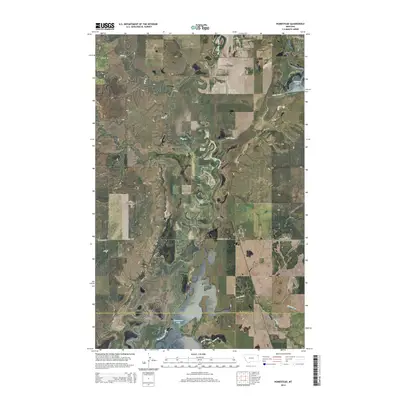
2014 Map of Homestead
USGS Topo · Published 2014About this map
Homestead serves as the primary settlement hub on this northeastern Montana landscape, situated at the intersection of Homestead Hwy and Lost Creek Rd. The terrain is defined by an intricate network of waterways, including the winding Big Muddy Creek and its various tributaries such as Wolf Cr and Lake Creek. To the north, the southern tip of Medicine Lake reaches into the quadrangle, while Homestead Lake lies to the south, surrounded by the distinctive relief of Sauerkraut Coulee. This survey captures the border region between Sheridan and Roosevelt counties, revealing a traditional township and range grid system overlaid with rural routes like Lobo Rd and Buffalo Rd. The presence of numerous creeks like McCabe Cr and Sheep Creek suggests a well-watered prairie environment vital for the local agricultural economy.
Find a feature on this map
26 named features on this map. Tap any name to fly to it.
Don’t see what you’re looking for? This feature index may not catch every label — zoom into the map to look around manually.
Map Details
Editions of this 2014 Homestead Map
This is the sole edition of this map. No revisions or reprints were ever made.
Other maps of this area

1914 · Homestead
USGS Topo · 1:62,500

1947 · Rocky Point
USGS Topo · 1:24,000

1947 · Homestead
USGS Topo · 1:24,000

1948 · Homestead
USGS Topo · 1:24,000

1948 · Rocky Point
USGS Topo · 1:24,000

1948 · Medicine Lake
USGS Topo · 1:24,000

1948 · Reserve
USGS Topo · 1:24,000

1948 · Alkali Coulee
USGS Topo · 1:24,000

1949 · Reserve
USGS Topo · 1:24,000

1949 · Alkali Coulee
USGS Topo · 1:24,000