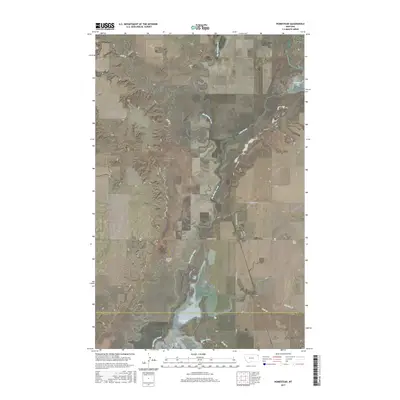
2017 Map of Homestead
USGS Topo · Published 2017About this map
Homestead serves as the primary settlement in this corner of Northeast Montana, where the prairie landscape is defined by the winding course of Big Muddy Creek and the expansive waters of Medicine Lake. The map captures a transition between the elevated topography of Sauerkraut Coulee and the low-lying wetlands surrounding Homestead Lake. The grid of local roads, including Charlesworth Ave and Section Ave, reveals a late-twentieth-century development pattern imposed upon the traditional township and range divisions. Water management is a central theme of this terrain, with numerous drainages such as Wolf Cr and Sheep Creek feeding into the larger creek system, illustrating the hydrology of Sheridan and Roosevelt counties before the most recent landscape modifications. This survey documents the intersection of rural agriculture and the unique glacial prairie pothole environment characteristic of the High Plains.
Find a feature on this map
24 named features on this map. Tap any name to fly to it.
Don’t see what you’re looking for? This feature index may not catch every label — zoom into the map to look around manually.
Map Details
Editions of this 2017 Homestead Map
This is the sole edition of this map. No revisions or reprints were ever made.
Other maps of this area

1914 · Homestead
USGS Topo · 1:62,500

1947 · Rocky Point
USGS Topo · 1:24,000

1947 · Homestead
USGS Topo · 1:24,000

1948 · Homestead
USGS Topo · 1:24,000

1948 · Rocky Point
USGS Topo · 1:24,000

1948 · Medicine Lake
USGS Topo · 1:24,000

1948 · Reserve
USGS Topo · 1:24,000

1948 · Alkali Coulee
USGS Topo · 1:24,000

1949 · Reserve
USGS Topo · 1:24,000

1949 · Alkali Coulee
USGS Topo · 1:24,000