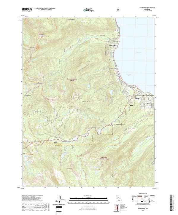
2021 Map of Homewood
USGS Topo · Published 2021About this map
Homewood and Tahoma anchor the western shore of Lake Tahoe in this detailed survey of the Sierra Nevada's eastern slopes. The residential and resort corridors along W Lake Blvd contrast with the expansive backcountry of the Tahoe National Forest and Eldorado National Forest. High-elevation landmarks such as Stanford Rock, Ellis Peak, and Barker Peak overlook a landscape carved by Blackwood Creek and the headwaters of the Rubicon River. The map highlights a complex network of recreational routes, including the Pacific Crest National Scenic Trail and the Tahoe Rim Trail, which navigate the ridgelines of Blackwood Ridge and Knee Ridge. Numerous alpine basins are documented, from Miller Lake to the secluded Richardson Lake, illustrating the transition from the developed lakefront at McKinney Bay to the protected wilderness spanning the Placer and El Dorado county line.
Find a feature on this map
90 named features on this map. Tap any name to fly to it.
Don’t see what you’re looking for? This feature index may not catch every label — zoom into the map to look around manually.
Map Details
Editions of this 2021 Homewood Map
This is the sole edition of this map. No revisions or reprints were ever made.
Other maps of this area

1889 · Pyramid Peak
USGS Topo · 1:125,000

1891 · Truckee
USGS Topo · 1:125,000

1891 · Pyramid Peak
USGS Topo · 1:125,000

1893 · Truckee
USGS Topo · 1:125,000

1895 · Pyramid Peak
USGS Topo · 1:125,000

1895 · Truckee
USGS Topo · 1:125,000

1896 · Pyramid Peak
USGS Topo · 1:125,000

1932 · Truckee
USGS Topo · 1:96,000

1940 · Truckee
USGS Topo · 1:125,000

1947 · Sacramento
USGS Topo · 1:250,000