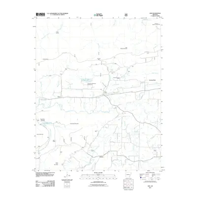
2011 Map of Hon
USGS Topo · Published 2011About this map
The Poteau River flows through this Scott County landscape, carving a wide valley between the high ridges of Poteau Mountain to the north and Cross Creek Mountain and Wolf Ridge to the south. Small settlements like Hon and Bryan are concentrated along the river corridor, while Winfield sits tucked near the southern slopes. This 2011 survey documents a mix of traditional land use and modern water management, seen in features like the Poteau River Watershed Site 16 Lake and its corresponding dam. For those researching local families, the map identifies several burial sites including Anthony Cemetery and Pearson Cemetery. Transportation is anchored by a dense network of county roads, while the Arkansas Western Landing Strip in the northeast corner highlights the area's light aviation connection. Significant elevation changes are marked by landmarks like Lookout Gap and Hickory Knob, which offer perspective over the various branches of the river system.
Find a feature on this map
67 named features on this map. Tap any name to fly to it.
Don’t see what you’re looking for? This feature index may not catch every label — zoom into the map to look around manually.
Map Details
Editions of this 2011 Hon Map
This is the sole edition of this map. No revisions or reprints were ever made.
Other maps of this area

1879 · Poteau Mountain
USGS Topo · 1:62,500

1887 · Poteau Mountain #1
USGS Topo · 1:62,500

1887 · Poteau Mountain #2
USGS Topo · 1:62,500

1887 · Greenwood
USGS Topo · 1:62,500

1890 · Fort Smith
USGS Topo · 1:125,000

1890 · Poteau Mountain
USGS Topo · 1:125,000

1899 · Poteau Mountain
USGS Topo · 1:125,000

1906 · Barber
USGS Topo · 1:62,500

1939 · Waldron
USGS Topo · 1:62,500

1940 · Waldron
USGS Topo · 1:62,500