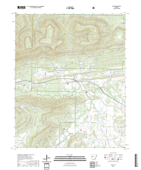
2024 Map of Hon
USGS Topo · Published 2024About this map
The Poteau River winds through this section of the Ouachita National Forest, framing a landscape defined by significant elevation changes between Poteau Mountain and Chalybeate Mountain. The small settlements of Hon and Winfield serve as the primary hubs for the surrounding rural homesteads and agricultural plots. Local genealogy is well-preserved through several family and community burial sites, including Anthony Cemetery and Sehorn Cemetery. The northern portion of the map is dominated by the Poteau Mountain Wilderness, where the terrain rises toward Hickory Knob and East Poteau Mountain. Water management features like the Poteau River Watershed Site Eight Lake and various creeks such as Bull Creek and Jones Creek illustrate the complex drainage system of the Scott County highlands.
Find a feature on this map
82 named features on this map. Tap any name to fly to it.
Don’t see what you’re looking for? This feature index may not catch every label — zoom into the map to look around manually.
Map Details
Editions of this 2024 Hon Map
This is the sole edition of this map. No revisions or reprints were ever made.
Other maps of this area

1879 · Poteau Mountain
USGS Topo · 1:62,500

1887 · Poteau Mountain #1
USGS Topo · 1:62,500

1887 · Poteau Mountain #2
USGS Topo · 1:62,500

1887 · Greenwood
USGS Topo · 1:62,500

1890 · Fort Smith
USGS Topo · 1:125,000

1890 · Poteau Mountain
USGS Topo · 1:125,000

1899 · Poteau Mountain
USGS Topo · 1:125,000

1906 · Barber
USGS Topo · 1:62,500

1939 · Waldron
USGS Topo · 1:62,500

1940 · Waldron
USGS Topo · 1:62,500