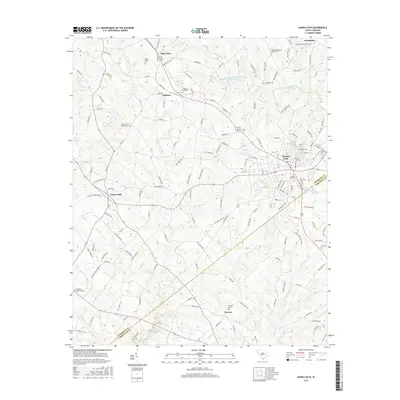
2017 Map of Honea Path
USGS Topo · Published 2017About this map
Honea Path anchors the eastern edge of this landscape, where the Anderson and Abbeville county line cuts through the Piedmont terrain. Small communities and rural crossroads such as Craytonville, Dosheno, and Keowee are connected by a network of local routes including Robinson Rd and Mahaffey Rd. The area is notably dense with family and community burial sites, from the large Garden of Memories and Honea Path Cem to smaller locations like the Greer Family Cem and Kay Cem.
Find a feature on this map
151 named features on this map. Tap any name to fly to it.
Don’t see what you’re looking for? This feature index may not catch every label — zoom into the map to look around manually.
Map Details
Editions of this 2017 Honea Path Map
This is the sole edition of this map. No revisions or reprints were ever made.
Other maps of this area

1888 · Pickens
USGS Topo · 1:125,000

1892 · Abbeville
USGS Topo · 1:125,000

1893 · Elberton
USGS Topo · 1:125,000

1894 · Pickens
USGS Topo · 1:125,000

1954 · Greenville
USGS Topo · 1:250,000

1957 · Anderson
USGS Topo · 1:62,500

1957 · Williamston
USGS Topo · 1:62,500

1958 · Greenville
USGS Topo · 1:250,000

1964 · Antreville
USGS Topo · 1:24,000

1964 · Saylors Crossroads
USGS Topo · 1:24,000