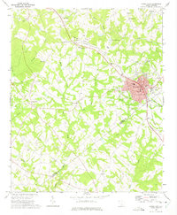
1970 Map of Honea Path
USGS Topo · Published 1975About this map
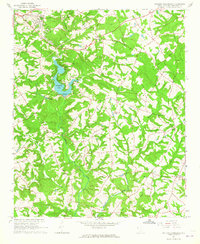
The town of Honea Path serves as the focal point of this 1970 landscape, where the Seaboard Coast Line and Southern railroads intersect to drive the local economy. The map captures a detailed street grid including Shirley Ave, Maryland Ave, and Main St, alongside civic markers like the Post Office and City Hall. Beyond the town center, the terrain is defined by a dense network of country churches and schools that anchored the rural community, such as Barkers Creek Ch, St James Ch, and the Belton-Honea Path High Sch. Along the Anderson Co Abbeville Co line, the topography drops toward watercourses like Broad Mouth Creek and Barkers Creek. This survey includes unique details such as the red-dashed lines indicating property fences and field boundaries, providing an intimate view of land use before modern suburban expansion.
Find a feature on this map
52 named features on this map. Tap any name to fly to it.
Don’t see what you’re looking for? This feature index may not catch every label — zoom into the map to look around manually.
Map Details
Editions of this 1970 Honea Path Map
This is the sole edition of this map. No revisions or reprints were ever made.
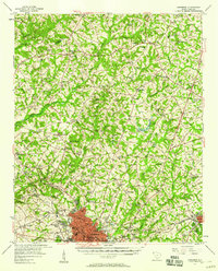
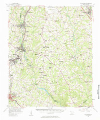
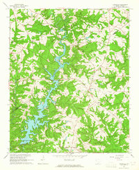
Other maps of this area

1888 · Pickens
USGS Topo · 1:125,000

1892 · Abbeville
USGS Topo · 1:125,000

1893 · Elberton
USGS Topo · 1:125,000

1894 · Pickens
USGS Topo · 1:125,000

1954 · Greenville
USGS Topo · 1:250,000
1957 · Anderson
USGS Topo · 1:62,500
1957 · Williamston
USGS Topo · 1:62,500

1958 · Greenville
USGS Topo · 1:250,000
1964 · Antreville
USGS Topo · 1:24,000
1964 · Saylors Crossroads
USGS Topo · 1:24,000