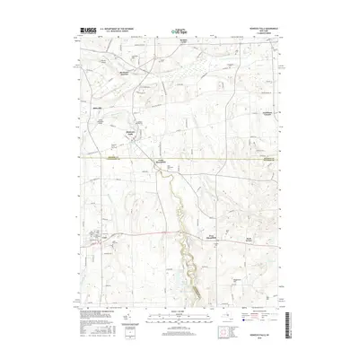
2016 Map of Honeoye Falls
USGS Topo · Published 2016About this map
Honeoye Creek flows through the center of this landscape, anchoring the village of Honeoye Falls and the settlement of North Bloomfield at the junction of Monroe, Ontario, and Livingston counties. The area is marked by a high concentration of burial sites, including the Quaker Cem, Chamberlain Cem, and Miller Cem, which provide significant points of interest for genealogical research near Mendon Center. Transport and aviation history are evident through Rochester Junction and the presence of Skyview Airport and Smiths Land Base Airport. The terrain rises to several named points such as Woodchuck Hill and Junction Hill, while the southern reaches of the quadrangle feature a cluster of small water bodies like Long Pond and Mud Pond. Local institutions such as the Saint Paul of the Cross Cem and the Coll Hill school site reflect the established community fabric of the region.
Find a feature on this map
111 named features on this map. Tap any name to fly to it.
Don’t see what you’re looking for? This feature index may not catch every label — zoom into the map to look around manually.
Map Details
Editions of this 2016 Honeoye Falls Map
This is the sole edition of this map. No revisions or reprints were ever made.
Other maps of this area

1895 · Rochester
USGS Topo · 1:62,500

1898 · Rochester
USGS Topo · 1:62,500

1900 · Macedon
USGS Topo · 1:62,500

1900 · Canandaigua
USGS Topo · 1:62,500

1901 · Honeoye
USGS Topo · 1:62,500

1903 · Canandaigua
USGS Topo · 1:62,500

1904 · Honeoye
USGS Topo · 1:62,500

1912 · Rochester
USGS Topo · 1:62,500

1920 · Rochester
USGS Topo · 1:62,500

1931 · Mendon Ponds
USGS Topo · 1:24,000