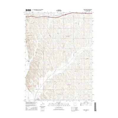
2015 Map of Honey Creek
USGS Topo · Published 2015About this map
Crescent and the unincorporated community of Honey Creek anchor this section of Pottawattamie County, Iowa, as it appeared in the mid-2010s. The landscape is defined by the drainage basins of Pigeon Creek and Honey Creek, which cut through the undulating Loess Hills terrain. For genealogists and local historians, the sheet is exceptionally dense with burial grounds, including Saint Bridgett Cemetery and Saint Pauls Lutheran Cemetery, alongside smaller family or church plots such as Branson Cemetery, Crook Cemetery, and McIntosh Cemetery. Transport routes like the Old Lincoln Highway trace the historic corridors of the region, while modern residential development is evident through named roads like Whippoorwill Road and Ski Hill Loop. This survey provides a precise record of the enduring rural cemeteries and evolving rural-suburban interface of the Missouri River bluff country.
Find a feature on this map
43 named features on this map. Tap any name to fly to it.
Don’t see what you’re looking for? This feature index may not catch every label — zoom into the map to look around manually.
Map Details
Editions of this 2015 Honey Creek Map
This is the sole edition of this map. No revisions or reprints were ever made.
Other maps of this area

1893 · Omaha
USGS Topo · 1:62,500

1954 · Omaha
USGS Topo · 1:250,000

1956 · Underwood
USGS Topo · 1:24,000

1956 · Council Bluffs North
USGS Topo · 1:24,000

1956 · Omaha North
USGS Topo · 1:24,000

1956 · Mc Clelland
USGS Topo · 1:24,000

1957 · Omaha
USGS Topo · 1:250,000

1957 · Loveland
USGS Topo · 1:24,000

1957 · Honey Creek
USGS Topo · 1:24,000

1958 · Omaha
USGS Topo · 1:250,000