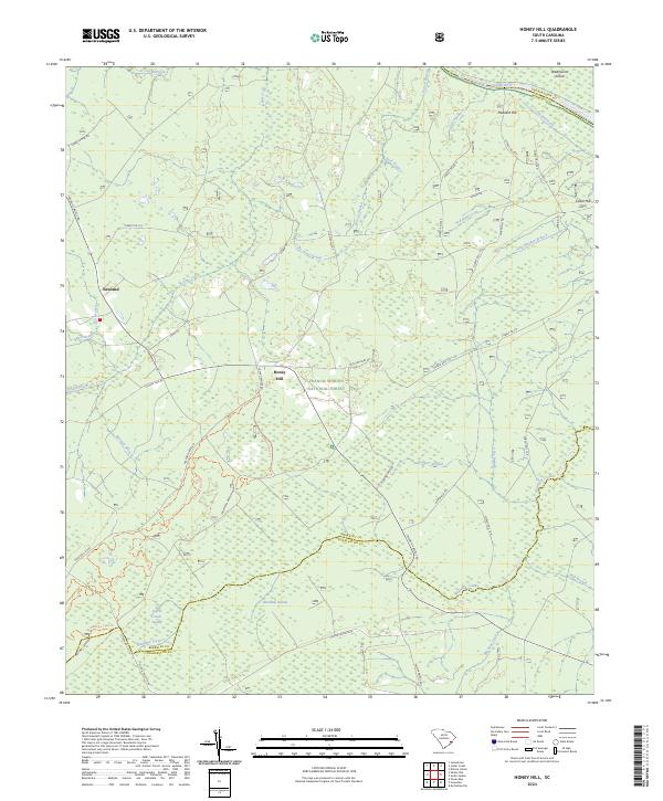
2024 Map of Honey Hill
USGS Topo · Published 2024About this map
Honey Hill sits at the heart of this Lowcountry landscape, where the dense woodlands of the Francis Marion National Forest meet a complex network of blackwater streams and swamps. Along the northern boundary, the Santee River forms a natural border with Georgetown County, flowing past Wadmacon Island and branching into smaller channels like Chicken Creek. This modern survey highlights the preservation of the coastal ecosystem, featuring the Wambaw Creek Wilderness and Wambaw Swamp Wilderness. The land use is defined by a deep-rooted connection to the water, illustrated by recreational paths like the Wambaw Creek Canoe Trl and the Chicken Creek Canoe Trl. Settlements such as Pleasant Hill and Cedar Hill are connected by a grid of forest service roads and local routes like Old Cemetery Rd, reflecting the area's rural character and long-standing timber and conservation history.
Find a feature on this map
57 named features on this map. Tap any name to fly to it.
Don’t see what you’re looking for? This feature index may not catch every label — zoom into the map to look around manually.
Map Details
Editions of this 2024 Honey Hill Map
This is the sole edition of this map. No revisions or reprints were ever made.
Other maps of this area

1942 · Cedar Creek
USGS Topo · 1:24,000

1942 · Mc Clellanville
USGS Topo · 1:24,000

1942 · Honey Hill
USGS Topo · 1:24,000

1943 · Shulerville
USGS Topo · 1:24,000

1943 · Kilsock Bay
USGS Topo · 1:24,000

1943 · Jamestown
USGS Topo · 1:24,000

1943 · Santee
USGS Topo · 1:24,000

1943 · Awendaw
USGS Topo · 1:24,000

1943 · Ocean Bay
USGS Topo · 1:24,000

1949 · Georgetown
USGS Topo · 1:250,000