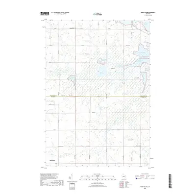
2018 Map of Honey Island
USGS Topo · Published 2018About this map
Auburndale anchors the southwest corner of this central Wisconsin landscape where the transition between Marathon and Wood Counties is defined by an intricate network of wetlands and managed waters. The Little Eau Pleine River winds through the northern half of the sheet, feeding into an extensive system of flowages including the Smoky Hill Flowage and North Honey Island Flowage. These water bodies surround distinctive landforms such as Honey Island and Smoky Hill, creating a complex aquatic geography.
Find a feature on this map
54 named features on this map. Tap any name to fly to it.
Don’t see what you’re looking for? This feature index may not catch every label — zoom into the map to look around manually.
Map Details
Editions of this 2018 Honey Island Map
This is the sole edition of this map. No revisions or reprints were ever made.
Other maps of this area

1902 · Marathon
USGS Topo · 1:125,000

1953 · Marathon
USGS Topo · 1:48,000

1953 · Stratford
USGS Topo · 1:48,000

1953 · Eau Claire
USGS Topo · 1:250,000

1954 · Marshfield
USGS Topo · 1:62,500

1955 · Green Bay
USGS Topo · 1:250,000

1956 · Milladore
USGS Topo · 1:48,000

1958 · Eau Claire
USGS Topo · 1:250,000

1963 · Marathon
USGS Topo · 1:62,500

1963 · Stratford
USGS Topo · 1:62,500