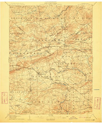
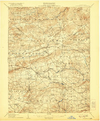
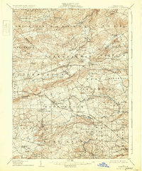
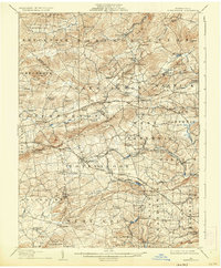
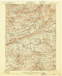
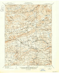
1907 Map of Honeybrook
USGS Topo · Published 1912About this map
Welsh Mountain and the surrounding tri-county borders of Berks, Lancaster, and Chester define this turn-of-the-century landscape. The area is marked by a dense network of early settlements and rural infrastructure, including many family-named landmarks like Hummels Store and Beckersville. The rail network is particularly active during this era, with the Pennsylvania RR and the Philadelphia and Reading RR serving stations such as Beartown Sta and White Bear Sta.
Find a feature on this map
115 named features on this map. Tap any name to fly to it.
Don’t see what you’re looking for? This feature index may not catch every label — zoom into the map to look around manually.
Map Details
Editions of this 1907 Honeybrook Map
7 editions found

Other maps of this area

1894 · Reading
USGS Topo · 1:62,500

1901 · West Chester
USGS Topo · 1:62,500

1902 · Boyertown
USGS Topo · 1:62,500

1902 · Wernersville
USGS Topo · 1:62,500

1904 · West Chester
USGS Topo · 1:62,500

1904 · Coatesville
USGS Topo · 1:62,500

1905 · Honey Brook
USGS Topo · 1:62,500

1906 · Phoenixville
USGS Topo · 1:62,500

1906 · Coatesville
USGS Topo · 1:62,500

1906 · New Holland
USGS Topo · 1:62,500