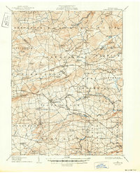
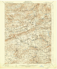
1907 Map of Honeybrook
USGS Topo · Published 1950About this map
Joanna Furnace anchors the central industrial history of this region, situated where the borders of Berks, Lancaster, and Chester Counties converge. The landscape at the turn of the century is defined by a dense network of iron-age heritage and early transport, with the Philadelphia and Reading and the Wilmington and Northern Division railroads threading through the valleys. The topography transitions from the prominent ridge of Welsh Mountain down to the fertile headwaters of Conestoga Creek, French Creek, and the West Branch Brandywine Creek. Dozens of local landmarks illustrate the social fabric of the era, including the Harmony Church, Stone Church, and rural education centers like Pineswamp School and Maxwell School. Larger settlements such as Morgantown, Elverson, and Honeybrook appear as established hubs connected by the historic Turnpike, while smaller railroad stops like White Bear Sta and Beartown Sta highlight the vital role of steam-era transit in daily commerce.
Find a feature on this map
125 named features on this map. Tap any name to fly to it.
Don’t see what you’re looking for? This feature index may not catch every label — zoom into the map to look around manually.
Map Details
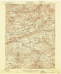
Editions of this 1907 Honeybrook Map
7 editions found

Other maps of this area

1894 · Reading
USGS Topo · 1:62,500

1901 · West Chester
USGS Topo · 1:62,500

1902 · Boyertown
USGS Topo · 1:62,500

1902 · Wernersville
USGS Topo · 1:62,500

1904 · West Chester
USGS Topo · 1:62,500

1904 · Coatesville
USGS Topo · 1:62,500

1905 · Honey Brook
USGS Topo · 1:62,500

1906 · Phoenixville
USGS Topo · 1:62,500

1906 · Coatesville
USGS Topo · 1:62,500

1906 · New Holland
USGS Topo · 1:62,500