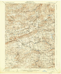
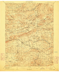
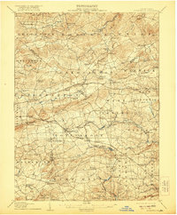
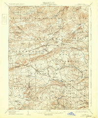
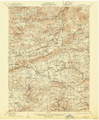
1907 Map of Honeybrook
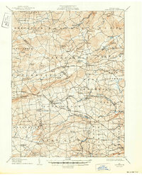
USGS Topo · Published 1936About this map
Welsh Mountain anchors the center of this landscape where the borders of Berks, Lancaster, and Chester counties converge during the early twentieth century. This region is characterized by a dense network of rural settlements and family-named locales, including Hummels Store, Scarlets Mill, and Geigers Mills. The industrial and social infrastructure of the era is evident in the numerous educational and religious sites such as Silver Hill School, Maxwell School, and the Stone Church.
Find a feature on this map
109 named features on this map. Tap any name to fly to it.
Don’t see what you’re looking for? This feature index may not catch every label — zoom into the map to look around manually.
Map Details
Editions of this 1907 Honeybrook Map
7 editions found

Other maps of this area

1894 · Reading
USGS Topo · 1:62,500

1901 · West Chester
USGS Topo · 1:62,500

1902 · Boyertown
USGS Topo · 1:62,500

1902 · Wernersville
USGS Topo · 1:62,500

1904 · West Chester
USGS Topo · 1:62,500

1904 · Coatesville
USGS Topo · 1:62,500

1905 · Honey Brook
USGS Topo · 1:62,500

1906 · Phoenixville
USGS Topo · 1:62,500

1906 · Coatesville
USGS Topo · 1:62,500

1906 · New Holland
USGS Topo · 1:62,500