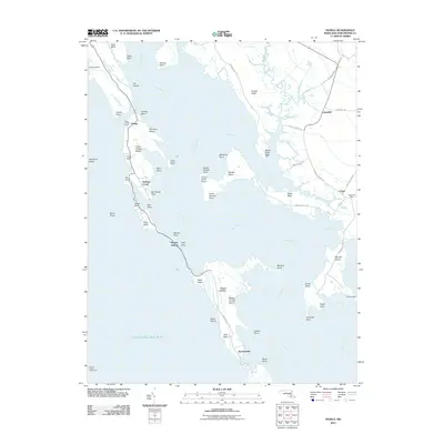
2011 Map of Honga
USGS Topo · Published 2011About this map
Hooper Islands stretch across the brackish waters of the Honga River and the Chesapeake Bay in this coastal Dorchester County study. The narrow, linear settlements of Fishing Creek and Hoopersville are connected by Hoopersville Rd, illustrating a community deeply tied to the water. This maritime geography is further defined by isolated landforms like Wroten Island, which contains the Wroten Island Airport, and the Hooper Island Lighthouse standing offshore. To the east, the mainland communities of Lakesville and Crapo are marked by their own infrastructure, including the Crapo Post Office. The map captures a landscape of marshy fingers and points, such as Parks Neck and Kirwan Neck, where the land yields to an intricate network of tidal coves including Bently Cove and Lakers Cove.
Find a feature on this map
68 named features on this map. Tap any name to fly to it.
Don’t see what you’re looking for? This feature index may not catch every label — zoom into the map to look around manually.
Map Details
Editions of this 2011 Honga Map
This is the sole edition of this map. No revisions or reprints were ever made.
Other maps of this area

1892 · Drum Point
USGS Topo · 1:62,500

1894 · Point Lookout
USGS Topo · 1:62,500

1898 · St. Marys
USGS Topo · 1:125,000

1901 · Drum Point
USGS Topo · 1:62,500

1903 · Bloodsworth Island
USGS Topo · 1:62,500

1905 · Crapo
USGS Topo · 1:62,500

1905 · Drum Point
USGS Topo · 1:62,500

1906 · St. Marys
USGS Topo · 1:125,000

1912 · Point Lookout
USGS Topo · 1:62,500

1937 · Point Lookout
USGS Topo · 1:62,500