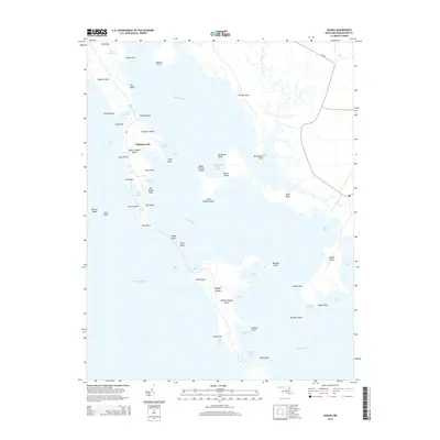
2014 Map of Honga
USGS Topo · Published 2014About this map
Fishing Creek serves as a primary settlement node along the eastern shore of the Honga River in this coastal reach of Dorchester County. The landscape is defined by a complex network of marshes and water bodies, including Tar Bay and the vast Chesapeake Bay. Notable landforms such as Upper Hooper Island, Wroten Island, and Barren Island illustrate the fragmented nature of the Maryland shoreline, where numerous necks like Meekins Neck and Kirwan Neck reach into the brackish waters. Small coves and guts, including Sols Point Gut and Bentley Cove, provide protected harbors for watermen. The presence of MD-336 provides the essential road connection through the peninsula, linking the isolated points and necks that define the local geography. This topography emphasizes the enduring reliance on the tides and marshes for the local economy and transportation patterns in a region where land and water are inextricably linked.
Find a feature on this map
62 named features on this map. Tap any name to fly to it.
Don’t see what you’re looking for? This feature index may not catch every label — zoom into the map to look around manually.
Map Details
Editions of this 2014 Honga Map
This is the sole edition of this map. No revisions or reprints were ever made.
Other maps of this area

1892 · Drum Point
USGS Topo · 1:62,500

1894 · Point Lookout
USGS Topo · 1:62,500

1898 · St. Marys
USGS Topo · 1:125,000

1901 · Drum Point
USGS Topo · 1:62,500

1903 · Bloodsworth Island
USGS Topo · 1:62,500

1905 · Crapo
USGS Topo · 1:62,500

1905 · Drum Point
USGS Topo · 1:62,500

1906 · St. Marys
USGS Topo · 1:125,000

1912 · Point Lookout
USGS Topo · 1:62,500

1937 · Point Lookout
USGS Topo · 1:62,500