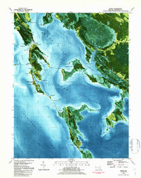
1984 Map of Honga
USGS Topo · Published 1984About this map
Middle Hoopers Island and the intricate Chesapeake shoreline of Dorchester County are revealed in this 1984 orthophotomap. This specialized survey combines traditional topographic contours with aerial photography, highlighting the fragile boundary between land and water in the Honga River estuary. Small bay-side settlements such as Hoopersville and Fishing Creek are visible, connected by a narrow thread of road that traverses the marshy landscape. To the north and east, the map details the rural character of communities like Lakesville and Crapo, which are surrounded by extensive wetlands including Beech Ground Swamp and Hook marsh. Local historical interest is anchored by features like Hoopers Mem Church and numerous named points and coves, such as Seven Oaks Pt and Bentley Cove, reflecting the maritime orientation of these isolated Eastern Shore necks.
Find a feature on this map
103 named features on this map. Tap any name to fly to it.
Don’t see what you’re looking for? This feature index may not catch every label — zoom into the map to look around manually.
Map Details
Editions of this 1984 Honga Map
This is the sole edition of this map. No revisions or reprints were ever made.
Other maps of this area

1892 · Drum Point
USGS Topo · 1:62,500

1894 · Point Lookout
USGS Topo · 1:62,500

1898 · St. Marys
USGS Topo · 1:125,000

1901 · Drum Point
USGS Topo · 1:62,500

1903 · Bloodsworth Island
USGS Topo · 1:62,500

1905 · Crapo
USGS Topo · 1:62,500

1905 · Drum Point
USGS Topo · 1:62,500

1906 · St. Marys
USGS Topo · 1:125,000

1912 · Point Lookout
USGS Topo · 1:62,500

1937 · Point Lookout
USGS Topo · 1:62,500