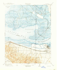
1918 Map of Honker Bay
USGS Topo · Published 1918About this map
Honker Bay and the surrounding delta landscape are defined by a complex network of marshes, sloughs, and islands at the confluence of the Sacramento River and the northern reaches of Suisun Bay. This 1918 edition reflects a transitional era where the maritime economy of the Carquinez Strait met the expanding industrial footprint of the East Bay. The southern shore shows the early development of Pittsburg and West Pittsburg, supported by a dense concentration of transit infrastructure including the Atchison Topeka and Santa Fe, the Southern Pacific, and the Oakland Antioch and Eastern railroads.
Find a feature on this map
54 named features on this map. Tap any name to fly to it.
Don’t see what you’re looking for? This feature index may not catch every label — zoom into the map to look around manually.
Map Details
Editions of this 1918 Honker Bay Map
2 editions found

Other maps of this area

1896 · Carquinez Strait
USGS Topo · 1:62,500

1896 · Mt. Diablo
USGS Topo · 1:62,500

1897 · Concord
USGS Topo · 1:62,500

1898 · Karquines
USGS Topo · 1:62,500

1898 · Mt. Diablo
USGS Topo · 1:62,500

1901 · Karquines
USGS Topo · 1:62,500

1902 · Napa
USGS Topo · 1:125,000

1907 · Antioch
USGS Topo · 1:62,500

1908 · Antioch
USGS Topo · 1:62,500

1915 · Concord
USGS Topo · 1:62,500