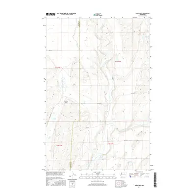
2017 Map of Honn Lakes
USGS Topo · Published 2017About this map
Honn Lakes and the surrounding drainage of the Palouse River characterize this portion of the Channeled Scablands along the Adams and Whitman county line. The landscape is defined by a series of north-to-south water features, including Lake Sixteen, Deep Lake, and Winn Lakes, illustrating the distinct geological patterns of the region. Local agriculture and transportation are represented by the Honn Farm Airport and a network of rural routes such as Benge-Winona Rd and Endicott W Rd. The map reveals numerous water sources vital to the area, from Rollie Springs to the cascades of Towell Falls on Rock Creek. Family-named landmarks like Lehrbas Spring and Hergert Lake provide valuable points of interest for genealogists and local historians tracing the development of this rural Washington corridor.
Find a feature on this map
27 named features on this map. Tap any name to fly to it.
Don’t see what you’re looking for? This feature index may not catch every label — zoom into the map to look around manually.
Map Details
Editions of this 2017 Honn Lakes Map
This is the sole edition of this map. No revisions or reprints were ever made.
Other maps of this area

1950 · La Crosse
USGS Topo · 1:62,500

1950 · Benge
USGS Topo · 1:62,500

1952 · La Crosse
USGS Topo · 1:62,500

1952 · Benge
USGS Topo · 1:62,500

1953 · Walla Walla
USGS Topo · 1:250,000

1953 · Ritzville
USGS Topo · 1:250,000

1955 · Pullman
USGS Topo · 1:250,000

1955 · Spokane
USGS Topo · 1:250,000

1958 · Spokane
USGS Topo · 1:250,000

1958 · Pullman
USGS Topo · 1:250,000