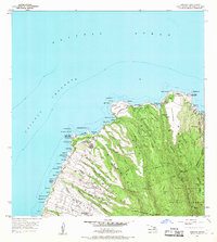
1956 Map of Honolua
USGS Topo · Published 1968About this map
Honokahua and the residential worker settlements of Kahana Camp and Mahinahina Camp anchor this coastal survey of Northwest Maui. Situated between the Pailolo Channel and the rising slopes of the West Maui Forest Reserve, the landscape is defined by the transition from agriculture and coastal ranching to preservation. The presence of a Heiau near Honokohau Bay and a Coast Guard Reservation at Hawea Point highlights the layering of traditional Hawaiian sites with modern military and maritime infrastructure. Transport is facilitated by the Honoapiilani Highway, which winds past numerous jagged points and bays, including Napili Bay and Honolua Bay. Inland, the terrain is deeply incised by gulches such as Honolua Stream and Honokahua Stream, where complex irrigation ditch systems support the valley's development.
Find a feature on this map
61 named features on this map. Tap any name to fly to it.
Don’t see what you’re looking for? This feature index may not catch every label — zoom into the map to look around manually.
Map Details
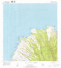
Editions of this 1956 Honolua Map
3 editions found
Other maps of this area

1952 · Halawa
USGS Topo · 1:24,000

1954 · Maui
USGS Topo · 1:250,000

1955 · Wailuku
USGS Topo · 1:24,000

1955 · Kahakuloa
USGS Topo · 1:24,000

1956 · Lahaina
USGS Topo · 1:24,000

1956 · Honolua
USGS Topo · 1:24,000

1966 · Maui
USGS Topo · 1:250,000

1968 · Halawa
USGS Topo · 1:24,000

1974 · Maui
USGS Topo · 1:250,000

1977 · Wailuku
USGS Topo · 1:24,000