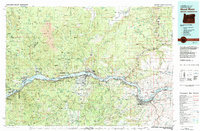
1982 Map of Hood River
USGS Topo · Published 1983About this map
The Columbia River serves as the central artery and political boundary for this 1980s-era map, dividing Washington and Oregon while connecting the settlements of Hood River and White Salmon. The landscape is dominated by massive federal and tribal lands, including the southern reaches of the Gifford Pinchot National Forest and the northern slopes of Mount Hood. This period shows the river fully harnessed by major infrastructure projects like the Bonneville Dam and The Dalles Dam, which fundamentally reshaped the shoreline and local economy.
Find a feature on this map
169 named features on this map. Tap any name to fly to it.
Don’t see what you’re looking for? This feature index may not catch every label — zoom into the map to look around manually.
Map Details
Editions of this 1982 Hood River Map
This is the sole edition of this map. No revisions or reprints were ever made.
Other maps of this area

1904 · Mount Adams
USGS Topo · 1:125,000

1907 · Mount Adams
USGS Topo · 1:125,000

1916 · Estacada
USGS Topo · 1:125,000

1919 · Mount St Helens
USGS Topo · 1:125,000

1924 · Mount Hood
USGS Topo · 1:125,000

1926 · Steamboat Mtn
USGS Topo · 1:125,000

1926 · Hood River
USGS Topo · 1:125,000

1927 · Mount Hood
USGS Topo · 1:125,000

1929 · Hood River
USGS Topo · 1:125,000

1930 · Dufur
USGS Topo · 1:125,000