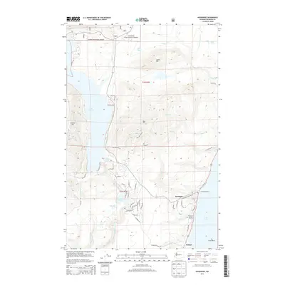
2014 Map of Hoodsport
USGS Topo · Published 2014About this map
Hoodsport sits at the junction of the mountains and the sea, where Finch Cr meets the tidal waters of Hood Canal. This 2014 survey captures a landscape defined by the steep transition from the peaks of the Olympic National Forest down to the shoreline. The local economy and environment are highlighted by the presence of the Hoodsport Hatchery and the Hood Canal Salmon Hatchery, which utilize the area's numerous freshwater sources like Miller Cr and Hill Cr. Further inland, the massive expanse of Lake Cushman dominates the western topography, flanked by significant elevations such as Dow Mtn and Cushman Hill. The road network, including Dow Mountain Rd and N Potlatch Rd, traces the contours of the Olympic foothills, connecting the coastal settlement at Potlatch to the high-country lakes and timberlands.
Find a feature on this map
62 named features on this map. Tap any name to fly to it.
Don’t see what you’re looking for? This feature index may not catch every label — zoom into the map to look around manually.
Map Details
Editions of this 2014 Hoodsport Map
This is the sole edition of this map. No revisions or reprints were ever made.
Other maps of this area

1938 · Mt Constance
USGS Topo · 1:125,000

1943 · Potlatch
USGS Topo · 1:62,500

1947 · The Brothers
USGS Topo · 1:62,500

1947 · Mt. Steel
USGS Topo · 1:62,500

1950 · The Brothers
USGS Topo · 1:62,500

1950 · Mt. Steel
USGS Topo · 1:62,500

1952 · Potlatch
USGS Topo · 1:62,500

1953 · Mt Tebo
USGS Topo · 1:62,500

1958 · Seattle
USGS Topo · 1:250,000

1962 · Seattle
USGS Topo · 1:250,000