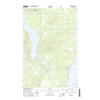
2017 Map of Hoodsport
USGS Topo · Published 2017About this map
Hoodsport and Potlatch anchor this coastal landscape where the steep foothills of the Olympic Peninsula meet the waters of Hood Canal. The terrain is defined by dramatic elevation changes, rising from the shoreline toward Dow Mtn and Saddle Mtn, while substantial water bodies like Lake Cushman and the smaller Lake Kokanee dominate the western interior. This 2017 survey illustrates the complex relationship between modern residential development and the natural environment, with a dense network of local roads such as N Lake Cushman Rd and Finch Creek Rd serving shoreline communities.
Find a feature on this map
72 named features on this map. Tap any name to fly to it.
Don’t see what you’re looking for? This feature index may not catch every label — zoom into the map to look around manually.
Map Details
Editions of this 2017 Hoodsport Map
This is the sole edition of this map. No revisions or reprints were ever made.
Other maps of this area

1938 · Mt Constance
USGS Topo · 1:125,000

1943 · Potlatch
USGS Topo · 1:62,500

1947 · The Brothers
USGS Topo · 1:62,500

1947 · Mt. Steel
USGS Topo · 1:62,500

1950 · The Brothers
USGS Topo · 1:62,500

1950 · Mt. Steel
USGS Topo · 1:62,500

1952 · Potlatch
USGS Topo · 1:62,500

1953 · Mt Tebo
USGS Topo · 1:62,500

1958 · Seattle
USGS Topo · 1:250,000

1962 · Seattle
USGS Topo · 1:250,000