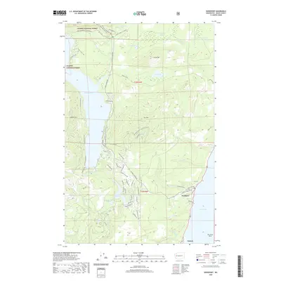
2020 Map of Hoodsport
USGS Topo · Published 2020About this map
Hoodsport and Potlatch anchor the eastern edge of this coastal landscape where the steep Olympic foothills meet The Great Bend of Hood Canal. The terrain is defined by dramatic elevation changes, rising from the shoreline to the heights of Saddle Mtn and Dow Mtn. A complex network of mountain roads like N Mount Seattle Way and N Lake Cushman Rd provide access to the interior, where water management and recreation are central features. Significant water bodies including Lake Cushman and the smaller Lake Kokanee are prominent, while the Olympic National Forest boundary encompasses much of the western map area. The presence of the Big Creek Campground and numerous creek systems such as Finch Creek and Lilliwaup Creek reflect a landscape heavily utilized for forest access and waterside settlement in the early 21st century.
Find a feature on this map
76 named features on this map. Tap any name to fly to it.
Don’t see what you’re looking for? This feature index may not catch every label — zoom into the map to look around manually.
Map Details
Editions of this 2020 Hoodsport Map
This is the sole edition of this map. No revisions or reprints were ever made.
Other maps of this area

1938 · Mt Constance
USGS Topo · 1:125,000

1943 · Potlatch
USGS Topo · 1:62,500

1947 · The Brothers
USGS Topo · 1:62,500

1947 · Mt. Steel
USGS Topo · 1:62,500

1950 · The Brothers
USGS Topo · 1:62,500

1950 · Mt. Steel
USGS Topo · 1:62,500

1952 · Potlatch
USGS Topo · 1:62,500

1953 · Mt Tebo
USGS Topo · 1:62,500

1958 · Seattle
USGS Topo · 1:250,000

1962 · Seattle
USGS Topo · 1:250,000