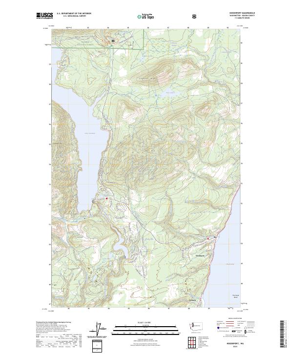
2023 Map of Hoodsport
USGS Topo · Published 2023About this map
The North Fork Skokomish River flows through a landscape defined by the steep elevation changes of the Olympic Peninsula, where the waters of Lake Cushman are contained by the rising slopes of Cushman Hill and Dow Mtn. Along the western shore of the Hood Canal, the community of Hoodsport serves as a gateway to the Olympic National Forest, while the settlement of Potlatch sits further south near The Great Bend.
Find a feature on this map
77 named features on this map. Tap any name to fly to it.
Don’t see what you’re looking for? This feature index may not catch every label — zoom into the map to look around manually.
Map Details
Editions of this 2023 Hoodsport Map
This is the sole edition of this map. No revisions or reprints were ever made.
Other maps of this area

1938 · Mt Constance
USGS Topo · 1:125,000

1943 · Potlatch
USGS Topo · 1:62,500

1947 · The Brothers
USGS Topo · 1:62,500

1947 · Mt. Steel
USGS Topo · 1:62,500

1950 · The Brothers
USGS Topo · 1:62,500

1950 · Mt. Steel
USGS Topo · 1:62,500

1952 · Potlatch
USGS Topo · 1:62,500

1953 · Mt Tebo
USGS Topo · 1:62,500

1958 · Seattle
USGS Topo · 1:250,000

1962 · Seattle
USGS Topo · 1:250,000