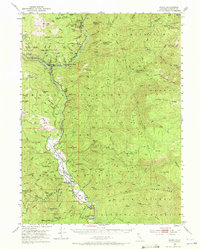
1952 Map of Hoopa
USGS Topo · Published 1972About this map
The Hoopa Valley Indian Reservation dominates this 1952 topographic study, showing the cultural and economic landscape of northern Humboldt County. The community of Hoopa sits at the heart of the valley, where the Klamath River carves through the terrain. The map reveals the area's industrial history through labels like Schnable (Placer Diggings) and the Red Cap Central Mine, while riverfront landmarks like Ferry Point and Saints Rest Bar indicate the historical reliance on water-based travel and access.
Find a feature on this map
107 named features on this map. Tap any name to fly to it.
Don’t see what you’re looking for? This feature index may not catch every label — zoom into the map to look around manually.
Map Details
Editions of this 1952 Hoopa Map
4 editions found

Other maps of this area

1909 · Big Bar
USGS Topo · 1:96,000

1915 · Big Bar and Vicinity
USGS Topo · 1:250,000

1922 · Korbel
USGS Topo · 1:62,500

1922 · China Flat
USGS Topo · 1:62,500

1925 · Hoopa
USGS Topo · 1:125,000

1945 · Coyote Peak
USGS Topo · 1:62,500

1945 · Tectah Creek
USGS Topo · 1:62,500

1945 · Blue Lake
USGS Topo · 1:62,500

1948 · Weed
USGS Topo · 1:250,000

1950 · Weed
USGS Topo · 1:250,000