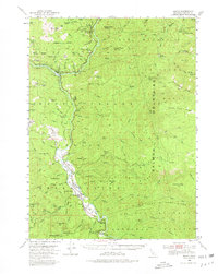
1952 Map of Hoopa
USGS Topo · Published 1980About this map
The Hoopa Valley Indian Reservation and the surrounding Six Rivers National Forest dominate this 1952 study, showing a landscape defined by the convergence of the Trinity and Klamath Rivers. In the heart of the valley, the community of Hoopa serves as a central hub, while the northern confluence at Weitchpec marks a significant cultural and geographic junction. The map documents an economy of scale and tradition, from the Indian Ceremonial Site near the river to resource extraction efforts like the Schnable (Placer Diggings) and Joe Marine Mine.
Find a feature on this map
101 named features on this map. Tap any name to fly to it.
Don’t see what you’re looking for? This feature index may not catch every label — zoom into the map to look around manually.
Map Details
Editions of this 1952 Hoopa Map
4 editions found

Other maps of this area

1909 · Big Bar
USGS Topo · 1:96,000

1915 · Big Bar and Vicinity
USGS Topo · 1:250,000

1922 · Korbel
USGS Topo · 1:62,500

1922 · China Flat
USGS Topo · 1:62,500

1925 · Hoopa
USGS Topo · 1:125,000

1945 · Coyote Peak
USGS Topo · 1:62,500

1945 · Tectah Creek
USGS Topo · 1:62,500

1945 · Blue Lake
USGS Topo · 1:62,500

1948 · Weed
USGS Topo · 1:250,000

1950 · Weed
USGS Topo · 1:250,000