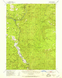
1952 Map of Hoopa
USGS Topo · Published 1957About this map
The Rain Rock (Indian Ceremonial Site) stands as a cultural landmark within the Hoopa Valley Indian Reservation in this 1950s study. The Trinity River corridor serves as the primary artery for settlement, connecting the community of Hoopa with northern outposts like Weitchpec. Along the riverbanks, the geography of early industry is evident through features such as Saints Rest Bar and Ferry Point, where a Ferry once provided a vital crossing before modern bridge networks fully matured.
Find a feature on this map
117 named features on this map. Tap any name to fly to it.
Don’t see what you’re looking for? This feature index may not catch every label — zoom into the map to look around manually.
Map Details
Editions of this 1952 Hoopa Map
4 editions found

Other maps of this area

1909 · Big Bar
USGS Topo · 1:96,000

1915 · Big Bar and Vicinity
USGS Topo · 1:250,000

1922 · Korbel
USGS Topo · 1:62,500

1922 · China Flat
USGS Topo · 1:62,500

1925 · Hoopa
USGS Topo · 1:125,000

1945 · Coyote Peak
USGS Topo · 1:62,500

1945 · Tectah Creek
USGS Topo · 1:62,500

1945 · Blue Lake
USGS Topo · 1:62,500

1948 · Weed
USGS Topo · 1:250,000

1950 · Weed
USGS Topo · 1:250,000