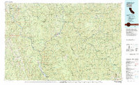
1983 Map of Hoopa
USGS Topo · Published 1983About this map
The confluence of the Klamath River and Trinity River at Weitchpec serves as the geographic heart of this 1983 study, highlighting a landscape defined by deep river canyons and high mountain ridges. Within the Hoopa Indian Reservation, the settlement of Hoopa sits along the Hoopa Valley, surrounded by the Six Rivers National Forest and the peaks of the Salmon Mountains.
Find a feature on this map
72 named features on this map. Tap any name to fly to it.
Don’t see what you’re looking for? This feature index may not catch every label — zoom into the map to look around manually.
Map Details
Editions of this 1983 Hoopa Map
This is the sole edition of this map. No revisions or reprints were ever made.
Other maps of this area

1886 · Shasta
USGS Topo · 1:250,000

1890 · Red Bluff
USGS Topo · 1:250,000

1894 · Red Bluff
USGS Topo · 1:250,000

1894 · Shasta
USGS Topo · 1:250,000

1909 · Big Bar
USGS Topo · 1:96,000

1913 · Weaverville
USGS Topo · 1:125,000

1914 · Seiad
USGS Topo · 1:125,000

1915 · Big Bar and Vicinity
USGS Topo · 1:250,000

1922 · Preston Peak
USGS Topo · 1:125,000

1922 · Eureka
USGS Topo · 1:62,500