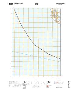
2020 Map of Hooper Bay A-2 SW
USGS Topo · Published 2020About this map
The vast coastal waters of the Bering Sea dominate this 2020 coastal survey of the Kusilvak Census Area. As part of the Hooper Bay A-2 SW quadrangle, the map highlights the intricate relationship between the maritime environment and the surveyed townships of the Yukon-Kuskokwim Delta. While much of the area is represented by open water, the inland boundary lines for t12n r92w and t11n r92w mark the formal organization of the Alaska Public Land Survey System. These grids reflect the administrative division of the coastal region during a period of modern geospatial monitoring, where shifting shorelines and maritime boundaries are of critical importance to local governance and land management.
Find a feature on this map
3 named features on this map. Tap any name to fly to it.
Don’t see what you’re looking for? This feature index may not catch every label — zoom into the map to look around manually.
Map Details
Editions of this 2020 Hooper Bay A-2 SW Map
This is the sole edition of this map. No revisions or reprints were ever made.
Other maps of this area

1951 · Hooper Bay
USGS Topo · 1:250,000

1951 · Nunivak Island
USGS Topo · 1:250,000
1952 · Hooper Bay A-2
USGS Topo · 1:63,360

1953 · Hooper Bay
USGS Topo · 1:250,000

1954 · Nunivak Island
USGS Topo · 1:250,000

1958 · Nunivak Island
USGS Topo · 1:250,000

1964 · Nunivak Island
USGS Topo · 1:250,000

1964 · Hooper Bay
USGS Topo · 1:250,000
2020 · Hooper Bay A-2 SE
USGS Topo · 1:25,000
2020 · Hooper Bay A-2 NE
USGS Topo · 1:25,000