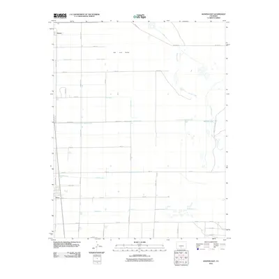
2010 Map of Hooper East
USGS Topo · Published 2010About this map
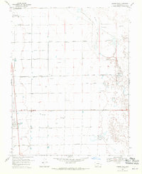
San Luis Valley agriculture and water management define this landscape east of Hooper and Mosca. The map illustrates an intricate network of human-made waterways designed to sustain the arid valley floor, including the San Luis Valley Irrigation Drain, Hooper Lateral, and the Streator Lateral. These systems converge with natural features like San Luis Creek as it flows toward the edge of San Luis Lakes State Park. The rigid grid of county roads, such as County Rd 110 and Eightmile Ln, reflects a disciplined approach to land division and rural settlement. Researchers can trace the path of water from the Gibson Ditch in the north down to Bachelor Lake, seeing how the engineered Prairie Ditch services the surrounding sections. This 2010 survey provides a clear view of the infrastructure supporting Colorado's high-altitude basin farming during the early 21st century.
Find a feature on this map
34 named features on this map. Tap any name to fly to it.
Don’t see what you’re looking for? This feature index may not catch every label — zoom into the map to look around manually.
Map Details
Editions of this 2010 Hooper East Map
This is the sole edition of this map. No revisions or reprints were ever made.
Other maps of this area

1954 · Trinidad
USGS Topo · 1:250,000

1955 · Trinidad
USGS Topo · 1:250,000

1958 · Trinidad
USGS Topo · 1:250,000

1959 · Trinidad
USGS Topo · 1:250,000

1965 · Medano Ranch
USGS Topo · 1:24,000

1965 · Dry Lakes
USGS Topo · 1:24,000
1966 · Mount Pleasant School
USGS Topo · 1:24,000
1966 · Hooper SE
USGS Topo · 1:24,000
1967 · Sand Camp
USGS Topo · 1:24,000
1968 · Hooper East
USGS Topo · 1:24,000