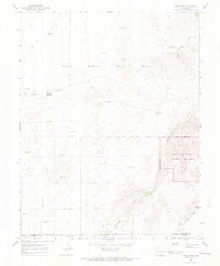
1967 Map of Sand Camp
USGS Topo · Published 1971About this map
The Luis Maria Baca No 4 Grant Boundary dominates this high-altitude landscape where the San Luis Valley meets the eastern foothills. This mid-1960s survey illustrates a region defined by complex hydrology and shifting sands, notably within the Great Sand Dunes National Monument. The reliance on artesian water is evident through numerous named water sources like Antelope Springs and the Sand Camp Flowing Well. A network of Jeep Trails provides the primary means of navigation across the Sand Dunes, connecting remote water points and monitoring stations across the Saguache and Alamosa county line. Drainages such as Sand Creek, Big Spring Creek, and Pole Creek trace the edge of the dunes, marking the unique intersection of desert-like formations and mountain runoff.
Find a feature on this map
11 named features on this map. Tap any name to fly to it.
Don’t see what you’re looking for? This feature index may not catch every label — zoom into the map to look around manually.
Map Details
Editions of this 1967 Sand Camp Map
3 editions found
Other maps of this area

1954 · Trinidad
USGS Topo · 1:250,000

1955 · Trinidad
USGS Topo · 1:250,000

1958 · Trinidad
USGS Topo · 1:250,000

1959 · Trinidad
USGS Topo · 1:250,000

1965 · Medano Ranch
USGS Topo · 1:24,000

1965 · Zapata Ranch
USGS Topo · 1:24,000
1967 · Crestone
USGS Topo · 1:24,000
1967 · Crestone Peak
USGS Topo · 1:24,000
1967 · Sheds Camp
USGS Topo · 1:24,000
1967 · Liberty
USGS Topo · 1:24,000