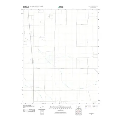
2010 Map of Hooper SE
USGS Topo · Published 2010About this map
Central Lateral defines the hydrological character of this landscape in the San Luis Valley, cutting a diagonal path across a grid-dominated agricultural region. This 2010 survey illustrates a sophisticated irrigation network necessary for high-altitude farming, where the Costilla Canal and South Lateral distribute water through a strictly partitioned landscape. The road system follows a rigid section-line geometry, with corridors like County Rd 112 and Stanley Rd providing access to expansive field plots. The map reveals the transition between these vast agricultural tracts and the emerging residential developments indicated by named clusters like Jasper Cir and the numbered streets of 1st Ave and 2nd Ave in the northeast. This interplay between the historic irrigation infrastructure and modern road naming conventions highlights the continued evolution of water-dependent land use in Alamosa County.
Find a feature on this map
31 named features on this map. Tap any name to fly to it.
Don’t see what you’re looking for? This feature index may not catch every label — zoom into the map to look around manually.
Map Details
Editions of this 2010 Hooper SE Map
This is the sole edition of this map. No revisions or reprints were ever made.
Other maps of this area

1954 · Trinidad
USGS Topo · 1:250,000

1955 · Trinidad
USGS Topo · 1:250,000

1958 · Trinidad
USGS Topo · 1:250,000

1959 · Trinidad
USGS Topo · 1:250,000

1965 · Medano Ranch
USGS Topo · 1:24,000

1965 · Baldy
USGS Topo · 1:24,000

1965 · Dry Lakes
USGS Topo · 1:24,000
1966 · Mount Pleasant School
USGS Topo · 1:24,000
1966 · Hooper SE
USGS Topo · 1:24,000
1966 · Alamosa East
USGS Topo · 1:24,000