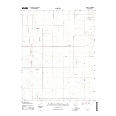
2016 Map of Hooper SE
USGS Topo · Published 2016About this map
Irrigation infrastructure and a rigid section-line road network define this landscape within Alamosa County during the early 21st century. The Costilla Canal and its associated waterways, including the Central Lateral and S Lateral, reflect the managed water systems necessary for high-altitude basin agriculture. The map reveals a transition from traditional rural routes like Co Rd 2 S and Co Rd 111 to more contemporary residential naming conventions such as Copper Dr, Coffeeberry Ln, and Mourning Dove Ln. This intersection of functional agricultural engineering and emerging rural development provides a clear view of the county's modern spatial organization, where long-established water rights still dictate the placement of roads like Stanley Rd and Mowery Dr.
Find a feature on this map
47 named features on this map. Tap any name to fly to it.
Don’t see what you’re looking for? This feature index may not catch every label — zoom into the map to look around manually.
Map Details
Editions of this 2016 Hooper SE Map
This is the sole edition of this map. No revisions or reprints were ever made.
Other maps of this area

1954 · Trinidad
USGS Topo · 1:250,000

1955 · Trinidad
USGS Topo · 1:250,000

1958 · Trinidad
USGS Topo · 1:250,000

1959 · Trinidad
USGS Topo · 1:250,000

1965 · Medano Ranch
USGS Topo · 1:24,000

1965 · Baldy
USGS Topo · 1:24,000

1965 · Dry Lakes
USGS Topo · 1:24,000
1966 · Mount Pleasant School
USGS Topo · 1:24,000
1966 · Hooper SE
USGS Topo · 1:24,000
1966 · Alamosa East
USGS Topo · 1:24,000