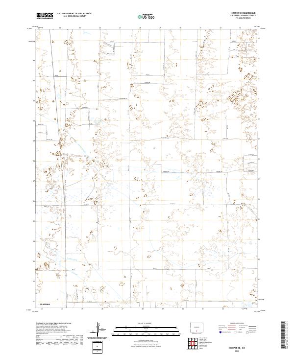
2022 Map of Hooper SE
USGS Topo · Published 2022About this map
The Costilla Canal and various irrigation channels like the Central Lateral and S Lateral define the agricultural geometry of this section of Alamosa. This 2022 survey shows a landscape organized by the Public Land Survey System, where townships such as t39n r11e and t38n r10e dictate the grid of rural roads and property lines. The naming conventions of local thoroughfares reflect a mix of geological and natural themes, seen in routes such as Kaolinite Dr, Basalt Ln, and Mourning Dove Ln. The map illustrates the sophisticated water management systems required for cultivation in this high-altitude valley, where canals and laterals are the primary landmarks across the open terrain.
Find a feature on this map
53 named features on this map. Tap any name to fly to it.
Don’t see what you’re looking for? This feature index may not catch every label — zoom into the map to look around manually.
Map Details
Editions of this 2022 Hooper SE Map
This is the sole edition of this map. No revisions or reprints were ever made.
Other maps of this area

1954 · Trinidad
USGS Topo · 1:250,000

1955 · Trinidad
USGS Topo · 1:250,000

1958 · Trinidad
USGS Topo · 1:250,000

1959 · Trinidad
USGS Topo · 1:250,000

1965 · Medano Ranch
USGS Topo · 1:24,000

1965 · Baldy
USGS Topo · 1:24,000

1965 · Dry Lakes
USGS Topo · 1:24,000
1966 · Mount Pleasant School
USGS Topo · 1:24,000
1966 · Hooper SE
USGS Topo · 1:24,000
1966 · Alamosa East
USGS Topo · 1:24,000