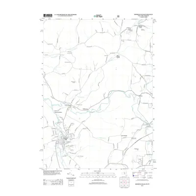
2013 Map of Hoosick Falls
USGS Topo · Published 2013About this map
Hoosick Falls and the winding Walloomsac River define this borderland landscape between New York and Vermont. The settlement pattern follows the river valleys, with clusters of activity at Hoosick Junction and North Hoosick. Industry and agriculture remain deeply etched into the topography, visible in features like the Burden Ore Bed and family-held lands such as Perrys Orchard and Elm Spring Farm. For genealogists, the map is remarkably detailed with local burial grounds, including the Quaker Cem and Shaftsbury Hollow Cem near the state line. Cultural landmarks like the Henry Covered Bridge and Hathaways Drive-In offer a view of the region's preserved heritage and mid-century recreation. The terrain rises significantly toward the east at Whipstock Hill, marking the transition from the river basin into the more elevated reaches of Shaftsbury Hollow.
Find a feature on this map
142 named features on this map. Tap any name to fly to it.
Don’t see what you’re looking for? This feature index may not catch every label — zoom into the map to look around manually.
Map Details
Editions of this 2013 Hoosick Falls Map
This is the sole edition of this map. No revisions or reprints were ever made.
Other maps of this area

1894 · Equinox
USGS Topo · 1:62,500

1895 · Cambridge
USGS Topo · 1:62,500

1896 · Equinox
USGS Topo · 1:62,500

1897 · Hoosick
USGS Topo · 1:62,500

1898 · Cambridge
USGS Topo · 1:62,500

1898 · Bennington
USGS Topo · 1:62,500

1900 · Taconic
USGS Topo · 1:125,000

1900 · Equinox
USGS Topo · 1:62,500

1901 · Cambridge
USGS Topo · 1:62,500

1903 · Mettawee
USGS Topo · 1:125,000