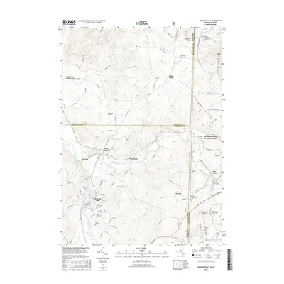
2016 Map of Hoosick Falls
USGS Topo · Published 2016About this map
Hoosick Falls serves as the primary hub where the Hoosic River and Walloomsac River meet the regional transport corridors. This modern survey illustrates the complex borderlands where New York and Vermont intersect, defined by the winding paths of Pan Am Railways and the eastern edge of the Green Mountain National Forest. Genealogists will find a landscape dotted with family and denominational history, from the Quaker Cem near White Creek to the Burden Ore Bed Sherwood Cem and Saint Marys Cem. The map preserves landmarks of engineering and industry, such as the Henry Covered Bridge and the Burden Ore Bed mining site. From the heights of Whipstock Hill to the rural settlements of North Hoosick and Walloomsac, the sheet details a corridor shaped by its rivers and railroads.
Find a feature on this map
128 named features on this map. Tap any name to fly to it.
Don’t see what you’re looking for? This feature index may not catch every label — zoom into the map to look around manually.
Map Details
Editions of this 2016 Hoosick Falls Map
This is the sole edition of this map. No revisions or reprints were ever made.
Other maps of this area

1894 · Equinox
USGS Topo · 1:62,500

1895 · Cambridge
USGS Topo · 1:62,500

1896 · Equinox
USGS Topo · 1:62,500

1897 · Hoosick
USGS Topo · 1:62,500

1898 · Cambridge
USGS Topo · 1:62,500

1898 · Bennington
USGS Topo · 1:62,500

1900 · Taconic
USGS Topo · 1:125,000

1900 · Equinox
USGS Topo · 1:62,500

1901 · Cambridge
USGS Topo · 1:62,500

1903 · Mettawee
USGS Topo · 1:125,000