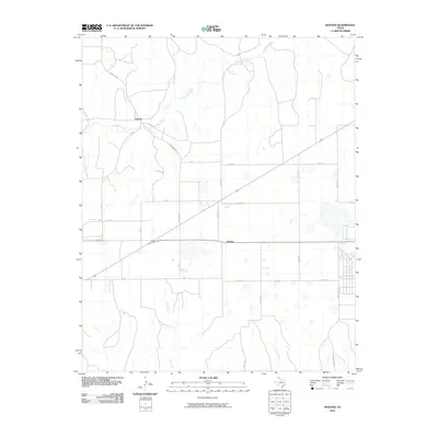
2010 Map of Hoover
USGS Topo · Published 2010About this map
Heaton and Hoover anchor this high plains landscape in the northeastern Texas Panhandle, where the terrain is defined by a series of intermittent drainages. The most prominent watercourse, Red Deer Creek, meanders through the northwest, joined further south by Thut Creek and Cabin Creek. The settlement pattern reflects the rigid grid of the region's agricultural and ranching heritage, with local thoroughfares like Gray 16 Rd and Ranch Rd 2391 cutting across the open country. This 2010 survey illustrates the sparse distribution of human activity, where small unincorporated communities are separated by wide stretches of land marked only by farm-to-market roads and seasonal creek beds.
Find a feature on this map
22 named features on this map. Tap any name to fly to it.
Don’t see what you’re looking for? This feature index may not catch every label — zoom into the map to look around manually.
Map Details
Editions of this 2010 Hoover Map
This is the sole edition of this map. No revisions or reprints were ever made.
Other maps of this area

1954 · Amarillo
USGS Topo · 1:250,000

1958 · Amarillo
USGS Topo · 1:250,000

1962 · Pond Creek NW
USGS Topo · 1:24,000

1963 · Pampa
USGS Topo · 1:24,000

1966 · Laketon
USGS Topo · 1:24,000

1966 · Bowers City
USGS Topo · 1:24,000

1967 · Lefors
USGS Topo · 1:24,000

1967 · Hoover
USGS Topo · 1:24,000

1971 · Pampa NW
USGS Topo · 1:24,000

1972 · Pampa NE
USGS Topo · 1:24,000