
1967 Map of Lefors
USGS Topo · Published 1969About this map
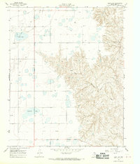
Lefors sits at the heart of this late-1960s landscape, positioned where the North Fork Red River begins its winding course eastward. The area is defined by the heavy footprint of the energy industry, with an extensive Gas and Oil Field and a significant Refinery operating to the west. This industrial infrastructure is closely tied to the transportation network, specifically the Fort Worth and Denver railroad which cuts diagonally across the terrain, serving the petroleum facilities and the small settlement at Wesco.
Find a feature on this map
16 named features on this map. Tap any name to fly to it.
Don’t see what you’re looking for? This feature index may not catch every label — zoom into the map to look around manually.
Map Details
Editions of this 1967 Lefors Map
This is the sole edition of this map. No revisions or reprints were ever made.
Other maps of this area

1954 · Amarillo
USGS Topo · 1:250,000

1958 · Amarillo
USGS Topo · 1:250,000

1962 · Hudgens Ranch
USGS Topo · 1:24,000

1962 · Pond Creek NW
USGS Topo · 1:24,000

1963 · Pampa
USGS Topo · 1:24,000

1966 · Laketon
USGS Topo · 1:24,000

1966 · Bowers City
USGS Topo · 1:24,000

1967 · Hoover
USGS Topo · 1:24,000

1968 · Taylor Ranch
USGS Topo · 1:24,000
1968 · Deep Lake
USGS Topo · 1:24,000