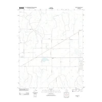
2012 Map of Hoover
USGS Topo · Published 2012About this map
Heaton and Hoover anchor this high plains landscape in the northeastern Texas Panhandle, where the natural drainage of Red Deer Cr and Thut Cr cuts through a grid of agricultural land and ranching pastures. The settlement patterns shown here are defined by the intersection of rural routes and rail corridors, including named points such as Benton, Spearman, and Lewis. The map reveals a highly structured environment of large tracts, accessed by family-named roads like Bowers Brown and Little Moody Pasture Rd. Water management and land use are central to the area's identity, evidenced by the presence of numerous small catchments and the prominent Waters label, suggesting the critical role of surface water and drainage in this semi-arid ranching country.
Find a feature on this map
33 named features on this map. Tap any name to fly to it.
Don’t see what you’re looking for? This feature index may not catch every label — zoom into the map to look around manually.
Map Details
Editions of this 2012 Hoover Map
This is the sole edition of this map. No revisions or reprints were ever made.
Other maps of this area

1954 · Amarillo
USGS Topo · 1:250,000

1958 · Amarillo
USGS Topo · 1:250,000

1962 · Pond Creek NW
USGS Topo · 1:24,000

1963 · Pampa
USGS Topo · 1:24,000

1966 · Laketon
USGS Topo · 1:24,000

1966 · Bowers City
USGS Topo · 1:24,000

1967 · Lefors
USGS Topo · 1:24,000

1967 · Hoover
USGS Topo · 1:24,000

1971 · Pampa NW
USGS Topo · 1:24,000

1972 · Pampa NE
USGS Topo · 1:24,000