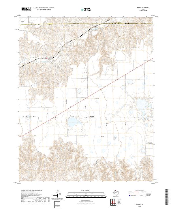
2022 Map of Hoover
USGS Topo · Published 2022About this map
The settlement of Heaton sits along the southern edge of this West Texas landscape, positioned where the high plains begin their descent into the drainage systems of the Panhandle. The northern portion of the map is defined by the Roberts Co and Gray Co boundary line, which crosses a terrain etched by the winding course of Red Deer Cr. This watercourse, along with Thut Cr and Cabin Cr, creates a complex network of draws and breaks that contrast with the organized grid of rural ranch roads like Ranch Rd 2391 and Gray 16 Rd. The presence of Lindel Dairy Rd and numerous unnamed wetlands suggests a landscape where local agricultural operations and water management are central to the regional economy. This modern survey provides an essential look at the contemporary land use and road networks that connect these remote High Plains ranching communities.
Find a feature on this map
27 named features on this map. Tap any name to fly to it.
Don’t see what you’re looking for? This feature index may not catch every label — zoom into the map to look around manually.
Map Details
Editions of this 2022 Hoover Map
This is the sole edition of this map. No revisions or reprints were ever made.
Other maps of this area

1954 · Amarillo
USGS Topo · 1:250,000

1958 · Amarillo
USGS Topo · 1:250,000

1962 · Pond Creek NW
USGS Topo · 1:24,000

1963 · Pampa
USGS Topo · 1:24,000

1966 · Laketon
USGS Topo · 1:24,000

1966 · Bowers City
USGS Topo · 1:24,000

1967 · Lefors
USGS Topo · 1:24,000

1967 · Hoover
USGS Topo · 1:24,000

1971 · Pampa NW
USGS Topo · 1:24,000

1972 · Pampa NE
USGS Topo · 1:24,000