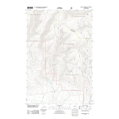
2011 Map of Hoover Spring
USGS Topo · Published 2011About this map
The headwaters of three major Montana drainage systems converge in this high-altitude landscape. The North Fork Smith River, North Fork Musselshell River, and South Fork Judith River all rise from the slopes surrounding Hoover Mountain and Burnt Ridge, tracing the intricate hydrology of the Little Belt Mountains. This network of cold-water creeks, including Whitetail Creek and Lion Creek, has long supported seasonal movement and light settlement in Judith Basin County.
Find a feature on this map
22 named features on this map. Tap any name to fly to it.
Don’t see what you’re looking for? This feature index may not catch every label — zoom into the map to look around manually.
Map Details
Editions of this 2011 Hoover Spring Map
This is the sole edition of this map. No revisions or reprints were ever made.
Other maps of this area

1886 · Little Belt Mts.
USGS Topo · 1:250,000

1894 · Little Belt Mts.
USGS Topo · 1:250,000

1897 · Little Belt Mts.
USGS Topo · 1:250,000

1898 · Little Belt Mts.
USGS Topo · 1:250,000

1902 · Little Belt Mts.
USGS Topo · 1:250,000

1948 · White Sulphur Springs
USGS Topo · 1:250,000

1958 · White Sulphur Springs
USGS Topo · 1:250,000

1961 · White Sulphur Springs
USGS Topo · 1:250,000
1961 · Kings Hill
USGS Topo · 1:24,000
1961 · Sand Point
USGS Topo · 1:24,000