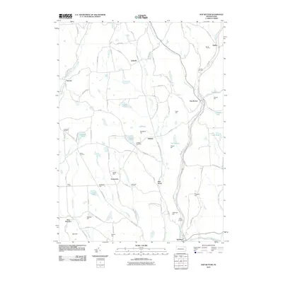
2010 Map of Hop Bottom
USGS Topo · Published 2010About this map
Martins Creek and Hop Bottom Creek converge at the borough of Hop Bottom, a centerpiece of this Susquehanna County landscape. The area is defined by its numerous small hamlets and family-named terrain features, reflecting a settlement pattern deeply tied to the narrow valleys and ridges. Water management is evident through features like the Lakeside Pond Dam and several scattered ponds including Tanner Pond and Schooley Pond. Local history and genealogy researchers will find several well-documented burial sites such as Saint Patricks Cemetery and Button Cemetery. To the south, the borough of Nicholson sits near the banks of Tunkhannock Creek, while smaller communities like Deckertown, Lindaville, and Hillsdale are connected by a network of state routes and township roads. These transportation corridors follow the natural contours carved by Field Brook and Horton Creek, illustrating the historical reliance on these waterways for early development.
Find a feature on this map
102 named features on this map. Tap any name to fly to it.
Don’t see what you’re looking for? This feature index may not catch every label — zoom into the map to look around manually.
Map Details
Editions of this 2010 Hop Bottom Map
This is the sole edition of this map. No revisions or reprints were ever made.
Other maps of this area

1892 · Dundaff
USGS Topo · 1:62,500

1932 · Susquehanna
USGS Topo · 1:62,500

1935 · Susquehanna
USGS Topo · 1:62,500

1943 · Montrose
USGS Topo · 1:62,500

1945 · Montrose
USGS Topo · 1:62,500

1946 · Tunkhannock
USGS Topo · 1:62,500

1946 · Dalton
USGS Topo · 1:24,000

1946 · Factoryville
USGS Topo · 1:24,000

1946 · Springville
USGS Topo · 1:24,000

1946 · Hop Bottom
USGS Topo · 1:24,000
Featured Places
- Lenox Township, PA
- Springville Township, PA
- Harford Township, PA
- Dimock Township, PA
- Brooklyn Township, PA