
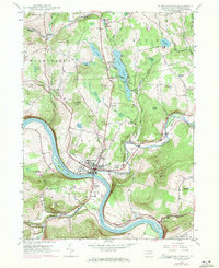
1946 Map of Hop Bottom
USGS Topo · Published 1971About this map
Martins Creek carves a deep valley through the center of this Northeast Pennsylvania landscape, serving as a corridor for both the Erie Lackawanna RR and U.S. 11. The topography is defined by significant ridges and hollows, where small settlements like Hop Bottom and Brooklyn established themselves along the valley floors. High-elevation wetlands and small bodies of water, including Kinney Swamp, Lakeside Pond, and Schooley Pond, are scattered across the uplands of Lathrop and Brooklyn townships.
Find a feature on this map
57 named features on this map. Tap any name to fly to it.
Don’t see what you’re looking for? This feature index may not catch every label — zoom into the map to look around manually.
Map Details
Editions of this 1946 Hop Bottom Map
This is the sole edition of this map. No revisions or reprints were ever made.
Other maps of this area

1892 · Dundaff
USGS Topo · 1:62,500

1932 · Susquehanna
USGS Topo · 1:62,500

1935 · Susquehanna
USGS Topo · 1:62,500

1943 · Montrose
USGS Topo · 1:62,500

1945 · Montrose
USGS Topo · 1:62,500

1946 · Tunkhannock
USGS Topo · 1:62,500

1946 · Dalton
USGS Topo · 1:24,000

1946 · Factoryville
USGS Topo · 1:24,000

1946 · Springville
USGS Topo · 1:24,000
1946 · Tunkhannock
USGS Topo · 1:24,000
Featured Places
- Lenox Township, PA
- Springville Township, PA
- Harford Township, PA
- Dimock Township, PA
- Brooklyn Township, PA